The stops
Keri caves, Cameo islet and Marathonisi explained
What the south-coast stops on the turtle trip are, what sources say about each and what the booking page says you do there.
Pick your date on the water ↗Quick answer
The trip passes Cameo islet, reaches the caves and arches of the Keri coast and ends with a swim at Marathonisi, an islet in Laganas Bay that locals call turtle island. The caves can only be reached from the sea, and some are too small for anything but a kayak.
Cameo islet
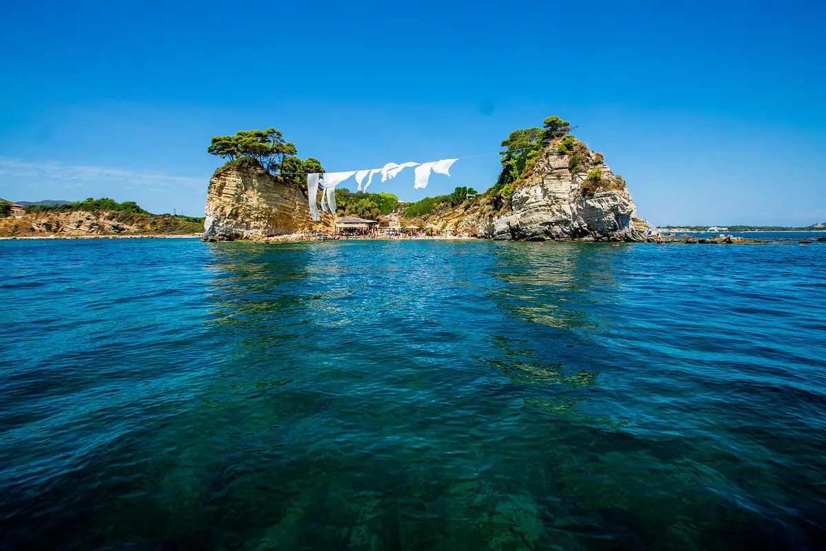
The booking page lists Cameo islet as a photo stop and presents it as created by an earthquake. It is a small wooded rock close to the shore. Photographs show it joined to the land by a short footbridge beside a harbour. For visitors it is a quick look and a good photograph, not a place to land.
The Keri coast and its caves
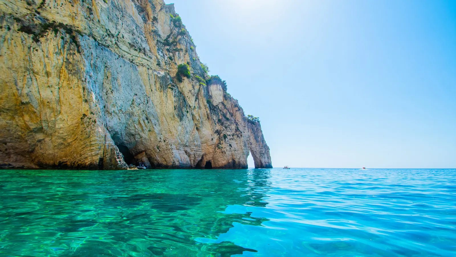
A travel site places the Keri caves on the Keri coastline between the Kapo Marathia and Mizithres rocks, from which it says they take their name, and says they are carved out of the cliffs over thousands of years. It says the only way to reach them is by sea. The booking page puts the caves on the south-western coast and says the boat passes through arches it calls Kamares, then goes close to and inside the caves so that guests can take photographs.
Which caves a boat can enter
The travel site says some boats go into the caves and that other caves have small entrances that can only be reached by kayak. A speedboat tour therefore sees some of the coast from inside and some from the water outside. The booking page lists visits inside the caves among the things included, and says the captains are allowed to change the itinerary for safety.
The swim stops
The booking page lists a first swim stop at a private beach it names Oasis, a swim at the Keri caves and a last swim at Marathonisi. It describes two or three swim stops in total. Bring swimwear and a towel, as the booking page asks.
Marathonisi
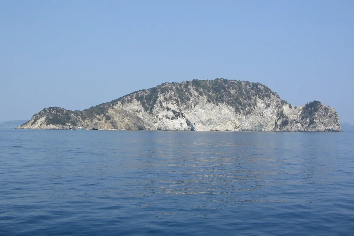
Wikipedia calls Marathonisi an uninhabited islet in Laganas Bay near Limni Keriou, with tropical vegetation, turquoise water, beaches and sea caves. The newspaper To Vima says locals call it turtle island because of its shape, that it is part of the national marine park and that its sandy beach of about 150 metres is a loggerhead nesting site. It says visitors may use the beach in daylight only and must stay within about five metres of the waterline, with no umbrellas, no disturbing of nests and no litter, and that boats must observe speed restrictions.
Reading the coast
Wikipedia describes Keri as a mountain village on the south of the island with a lighthouse, and places Marathonisi near Limni Keriou. ARCHELON adds the islet of Pelouso as part of the bay. For a visitor on the water, these names help to tell the stretches of coast apart: the sandy bay with its nesting beaches, the cliffs and caves of the Keri coast and the islet that gives the trip its turtle theme.
Read next: The loggerhead in Laganas Bay: nesting and what the park protects
Why caves are handled with care
Wikipedia says pregnant monk seals typically use inaccessible undersea caves when giving birth, and that the caves can be dangerous for newborns in storms. The booking page names the monk seal among the species the park protects. Nothing in the sources used here says seals use the Keri caves, so this is background on why sea caves matter to wildlife, not a prediction of what you will see.
Order and timing
The booking page says itineraries are subject to change, so a fixed order is not promised. Treat the stops as a list of what the day can include. Your own voucher and your captain set the plan on the day, and the weather can shorten or reroute any stop. A swim that is missed is not a fault in the trip; it is the sea deciding, which is also why no source here promises any single stop.
Frequently asked questions
Where are the Keri caves?
A travel site places them on the Keri coast between the Kapo Marathia and Mizithres rocks, reachable only from the sea.
Does the boat go inside the caves?
The booking page lists visits inside the caves. A travel site says some entrances are small enough to need a kayak.
Why is Marathonisi called turtle island?
To Vima says locals call it that because of its shape, and its beach is a loggerhead nesting site.
How many swim stops are there?
The booking page says two or three.
Can I visit Marathonisi's beach?
To Vima says visitors may use it in daylight only, within about five metres of the water, with no umbrellas.
Sources